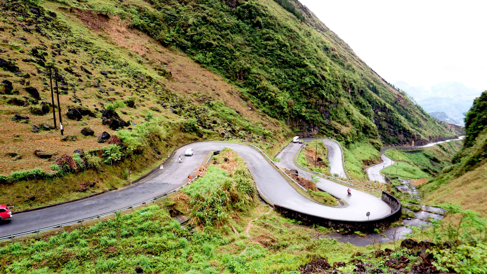
The Dong Van Karst Plateau is one of northern Vietnam’s most remarkable mountain landscapes, known for its dramatic limestone peaks, deep valleys, winding roads, and remote ethnic villages. Located in Ha Giang Province, this UNESCO Global Geopark offers a unique combination of geological heritage, cultural diversity, and spectacular scenery. Travelers can explore rocky plateaus, traditional Hmong communities, historic sites, and panoramic viewpoints along the Ha Giang Loop. For nature lovers, photographers, and cultural explorers, the Dong Van Karst Plateau provides an unforgettable journey through one of Vietnam’s most distinctive highland regions.
1. Why Visit the Dong Van Karst Plateau
The Dong Van Karst Plateau is one of the most distinctive destinations in northern Vietnam, combining dramatic geology, mountain culture, and remote border scenery within one region. Its sharp limestone peaks, deep valleys, winding passes, and ethnic villages create a landscape that feels both rugged and deeply connected to local life.
Explore a Rare Limestone Landscape
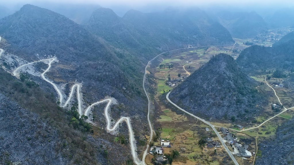
The plateau is defined by vast limestone formations that have been shaped over millions of years. Instead of smooth green hills, travelers encounter rocky mountains, narrow valleys, and steep slopes where villages and farmland have adapted to difficult natural conditions.
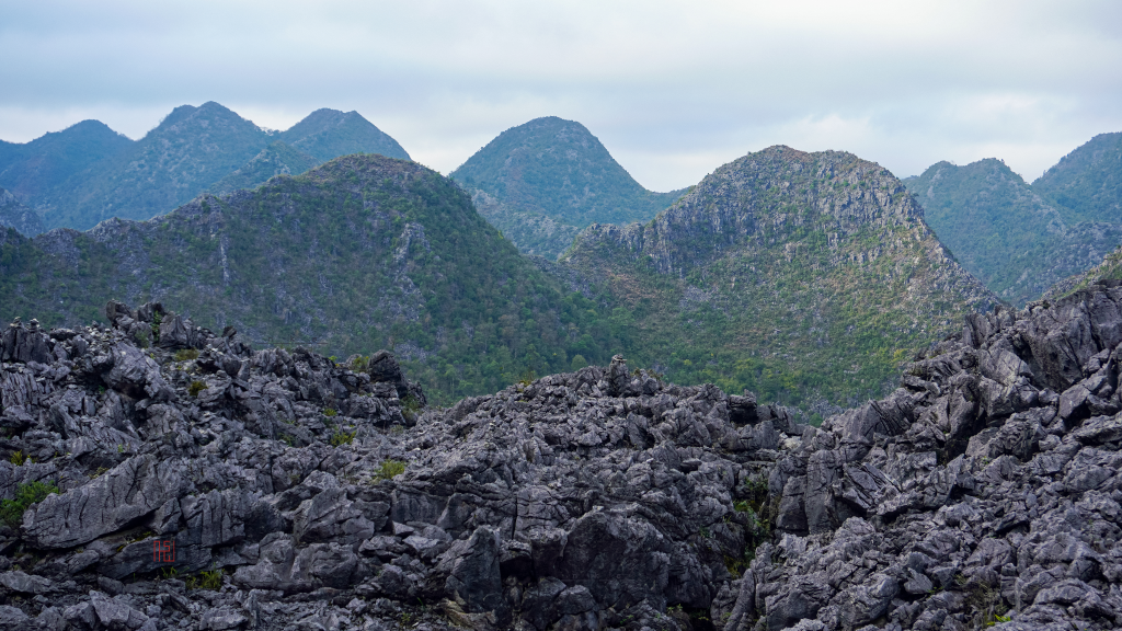
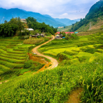
Dong Van Karst Plateau with Limestone Mountains and Deep Valleys. Picture: Internet.
During a journey through the Dong Van Karst Plateau, visitors may see:
- Towering limestone peaks and rocky ridges
- Deep valleys surrounded by dramatic cliffs
- Narrow roads crossing high mountain passes
- Small fields cultivated between stone formations
- Panoramic viewpoints overlooking remote settlements
This geological scenery gives the region a powerful and almost otherworldly appearance. The changing light, mist, and elevation also make each section of the journey feel different.
Discover UNESCO Global Geopark Heritage
The Dong Van Karst Plateau is recognized as a UNESCO Global Geopark because of its geological value, diverse landscapes, and cultural heritage. The designation highlights not only the region’s ancient rocks and landforms, but also the relationship between local communities and the mountain environment.
Travelers can learn how people have built homes, cultivated crops, and created transport routes within a rocky landscape. This connection between geology and daily life makes the plateau more meaningful than a destination valued only for photography.
Experience Ethnic Minority Culture
The plateau is home to Hmong, Dao, Lo Lo, Tay, Nung, and several other ethnic communities. Their architecture, clothing, farming practices, markets, and traditions add an important cultural dimension to the journey.
Depending on the route, travelers may encounter:
- Traditional earthen or wooden houses
- Stone walls surrounding homes and fields
- Handmade textiles and embroidered clothing
- Local markets selling food, tools, and crafts
- Seasonal farming activities on mountain slopes
These villages are living communities, so visitors should explore them respectfully. Travelers should ask before taking close-up photographs, avoid entering private homes without permission, and follow local guidance during cultural visits.
Travel Through Iconic Mountain Roads
The roads crossing the plateau are among the most memorable parts of the Ha Giang Loop. They connect Quan Ba, Yen Minh, Dong Van, Meo Vac, and smaller mountain communities while passing through constantly changing terrain.
The route may include:
- Steep mountain passes
- Sharp bends above deep valleys
- Narrow roads carved into rocky slopes
- Scenic stops near border areas
- Wide views of villages and farmland below
Traveling through these roads allows visitors to experience the scale of the plateau gradually. The journey itself becomes just as important as the destinations along the way.
Visit Dong Van Old Quarter
Dong Van Old Quarter provides a cultural and historical stop within the wider geopark. The town is known for its traditional architecture, market atmosphere, small cafés, and mountain setting.
Visitors can walk through the old streets, try regional food, and observe daily life in one of Ha Giang’s best-known towns. Staying overnight also gives travelers time to enjoy a quieter atmosphere after the main daytime traffic has passed.
See Ma Pi Leng Pass and the Nho Que River
Ma Pi Leng Pass is one of the most dramatic sections near the Dong Van Karst Plateau. The road follows high cliffs above the Nho Que River, offering broad views of deep canyons, rocky peaks, and winding mountain roads.
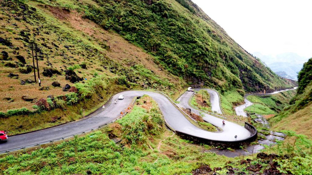
Ma Pi Leng Pass and Nho Que River Landscape in Ha Giang. Picture: Internet.
Travelers may stop at viewpoints, walk along short scenic paths, or join a boat trip on the river, depending on the itinerary. This combination of mountains and water creates one of the most recognizable landscapes in northern Vietnam.
A Strong Destination for Photography and Slow Exploration
The plateau is especially rewarding for photographers because the scenery changes with the weather, season, and time of day. Early morning mist, afternoon sunlight, stone villages, and high mountain roads all create different visual moods.
However, the Dong Van Karst Plateau is best experienced as more than a series of photo stops. Spending time in local towns, observing farming life, and learning about the geology helps travelers understand the region more deeply.
Overall, the Dong Van Karst Plateau offers a rare combination of UNESCO-recognized geology, ethnic culture, dramatic roads, and remote mountain scenery. It is an essential destination for travelers who want to discover one of Vietnam’s most powerful and culturally rich highland landscapes.
2. What to Expect When Exploring the Dong Van Karst Plateau
A journey through the Dong Van Karst Plateau combines scenic road travel, cultural encounters, geological landmarks, and time in remote mountain towns. Travelers should expect a full and varied experience, with long drives between attractions, frequent viewpoints, and changing weather across different elevations.
Dramatic Roads and Constantly Changing Scenery
Much of the experience takes place on winding mountain roads that connect the plateau’s towns and villages. The landscape changes gradually from rocky ridges and narrow valleys to steep passes, farmland, and isolated settlements.
Along the route, travelers may encounter:
- High mountain roads with sharp turns
- Limestone peaks rising above small villages
- Deep valleys and narrow canyon views
- Fields cultivated between rocky slopes
- Scenic stops overlooking remote communities
The journey can feel demanding because of the distance and terrain, but regular breaks help make it manageable. Travelers should treat the road as part of the experience rather than only a way to move between attractions.
Cooler Temperatures and Fast-Changing Weather
The plateau sits at a high elevation, so the weather is often cooler than in Hanoi or the lower valleys of Ha Giang. Conditions may change quickly, especially in the early morning or near exposed mountain passes.
Visitors should prepare for:
- Mist and low clouds
- Strong sunlight in open areas
- Sudden rain or cooler winds
- Reduced visibility on high roads
- Noticeable temperature changes between day and evening
Layered clothing, a light waterproof jacket, and comfortable shoes are useful throughout the trip. Flexible planning is also important because poor visibility or rain may affect the order of stops.
Ethnic Villages and Local Daily Life
The Dong Van Karst Plateau is home to diverse ethnic communities whose traditions remain closely connected to the mountain environment. Travelers may pass through villages where people farm rocky land, raise animals, sell goods at local markets, and maintain traditional architecture.
Ethnic Villages and Traditional Houses in Dong Van Karst Plateau. Picture: Internet.
Visitors may observe:
- Hmong earthen houses and stone walls
- Local people wearing traditional clothing
- Small farms built on steep terrain
- Markets selling food, textiles, and household goods
- Village roads shaped around limestone slopes
These are living communities rather than staged attractions. Travelers should ask permission before taking close-up photographs, avoid entering private homes without invitation, and follow local guidance during village visits.
Geological Features Beyond Scenic Views
The plateau’s value lies not only in its appearance, but also in its geological history. Rock formations, fossil areas, caves, and limestone structures reveal how the landscape developed over millions of years.
Depending on the itinerary, guides may explain:
- The formation of the karst plateau
- The age and structure of local limestone
- How erosion shaped valleys and cliffs
- The relationship between geology and settlement patterns
- Why the area received UNESCO Global Geopark status
This background helps travelers understand why the Dong Van Karst Plateau is important beyond tourism. It also adds meaning to viewpoints that might otherwise seem like simple photo stops.
Simple Accommodation in Mountain Towns
Travelers exploring the plateau often stay overnight in Dong Van, Meo Vac, Yen Minh, or nearby villages. Accommodation usually includes guesthouses, small hotels, or homestays rather than luxury resorts.
A typical overnight stay may involve:
- Basic but comfortable rooms
- Home-style meals
- Mountain or town views
- Quiet evenings after daytime travel
- Opportunities to meet local hosts or other travelers
The facilities may be simple, especially in more remote areas. However, the local atmosphere often becomes one of the most memorable parts of the journey.
Local Food and Regional Flavors
Meals are usually served in small restaurants, homestays, or market areas. The food tends to be simple and filling, with rice, vegetables, soups, meat dishes, and regional ingredients.
Travelers may try:
- Buckwheat-based dishes
- Corn-based local food
- Grilled meat and mountain vegetables
- Hot soups suited to the cooler climate
- Shared family-style meals
Dining is generally informal and closely connected to the local setting. Trying regional food also helps travelers experience the cultural side of the plateau more fully.
A Physically Active but Rewarding Journey
Exploring the plateau does not always involve difficult trekking, but travelers should expect a fair amount of walking, road travel, and time outdoors. Viewpoints, old streets, villages, and historical sites may include uneven paths, steps, or sloped terrain.
The experience is best suited to travelers who are comfortable with:
- Several hours of road travel
- Frequent stops and short walks
- Changing temperatures
- Basic accommodation
- A flexible daily schedule
With realistic expectations, the journey feels adventurous rather than tiring. The combination of dramatic scenery, local culture, and geological heritage makes the Dong Van Karst Plateau one of the most memorable regions in northern Vietnam.
3. Best Places to Visit in the Dong Van Karst Plateau
The Dong Van Karst Plateau includes a wide range of geological, cultural, and scenic attractions spread across Ha Giang’s northern districts. A well-planned route allows travelers to combine mountain passes, old towns, traditional villages, historical landmarks, and river viewpoints without making the journey feel repetitive.
Exploring Scenic Attractions in Dong Van Karst Plateau. Picture: Internet.
Dong Van Old Quarter
Dong Van Old Quarter is one of the most atmospheric stops in the geopark and a popular overnight base for travelers exploring the region. The compact town is surrounded by limestone mountains and features traditional houses, small cafés, local restaurants, and a central market area.
Visitors can walk through the old streets, enjoy regional food, and observe the slower rhythm of mountain life. The town is especially lively during market days, when ethnic communities from surrounding villages gather to trade food, textiles, agricultural products, and household goods.
Ma Pi Leng Pass
Ma Pi Leng Pass is one of the most dramatic viewpoints in the Dong Van Karst Plateau. The road runs along steep limestone slopes above the Nho Que River, creating panoramic views of deep valleys, rocky peaks, and winding mountain roads.
Travelers can stop at several viewpoints along the pass, but they should remain within safe areas and follow local guidance. The scenery is especially impressive in clear weather, although mist and clouds can create a more mysterious mountain atmosphere.
Nho Que River and Tu San Canyon
The Nho Que River flows beneath Ma Pi Leng Pass and forms one of the most recognizable landscapes in Ha Giang. Its green-blue water contrasts strongly with the high limestone cliffs and dry rocky terrain surrounding the canyon.
Depending on the itinerary, travelers may admire the river from above or take a boat trip through Tu San Canyon. The boat journey offers a closer view of the cliffs and provides a different perspective from the mountain road.
Lung Cu Flag Tower
Lung Cu Flag Tower is located in one of Vietnam’s northernmost areas and is often included in longer geopark itineraries. Reaching the top involves climbing several steps, but the surrounding views of border valleys, villages, and mountain landscapes make the effort worthwhile.
The site also has symbolic importance, so visitors should behave respectfully and follow all posted instructions. Clear weather provides the best visibility, while cooler or misty conditions create a more subdued atmosphere.
Hmong King’s Palace
The Hmong King’s Palace, also known as the Vuong Family Mansion, is an important historical and architectural site near Dong Van. The complex combines stone, wood, and tiled structures within a protected courtyard, reflecting both local traditions and outside influences.
A visit helps travelers understand the political and social history of the region beyond its natural scenery. Guided explanations are especially useful because many architectural details and historical stories may not be immediately obvious.
Pho Bang Ancient Town
Pho Bang is a quieter destination known for old earthen houses, narrow streets, and a more traditional atmosphere. Compared with Dong Van, the town receives fewer visitors and offers a slower experience that suits travelers interested in architecture and local daily life.
The muted colors of the houses and surrounding mountains create a distinctive visual character. Visitors should remember that Pho Bang remains a residential community, so respectful behavior is important when walking through the streets or taking photographs.
Sung La Valley
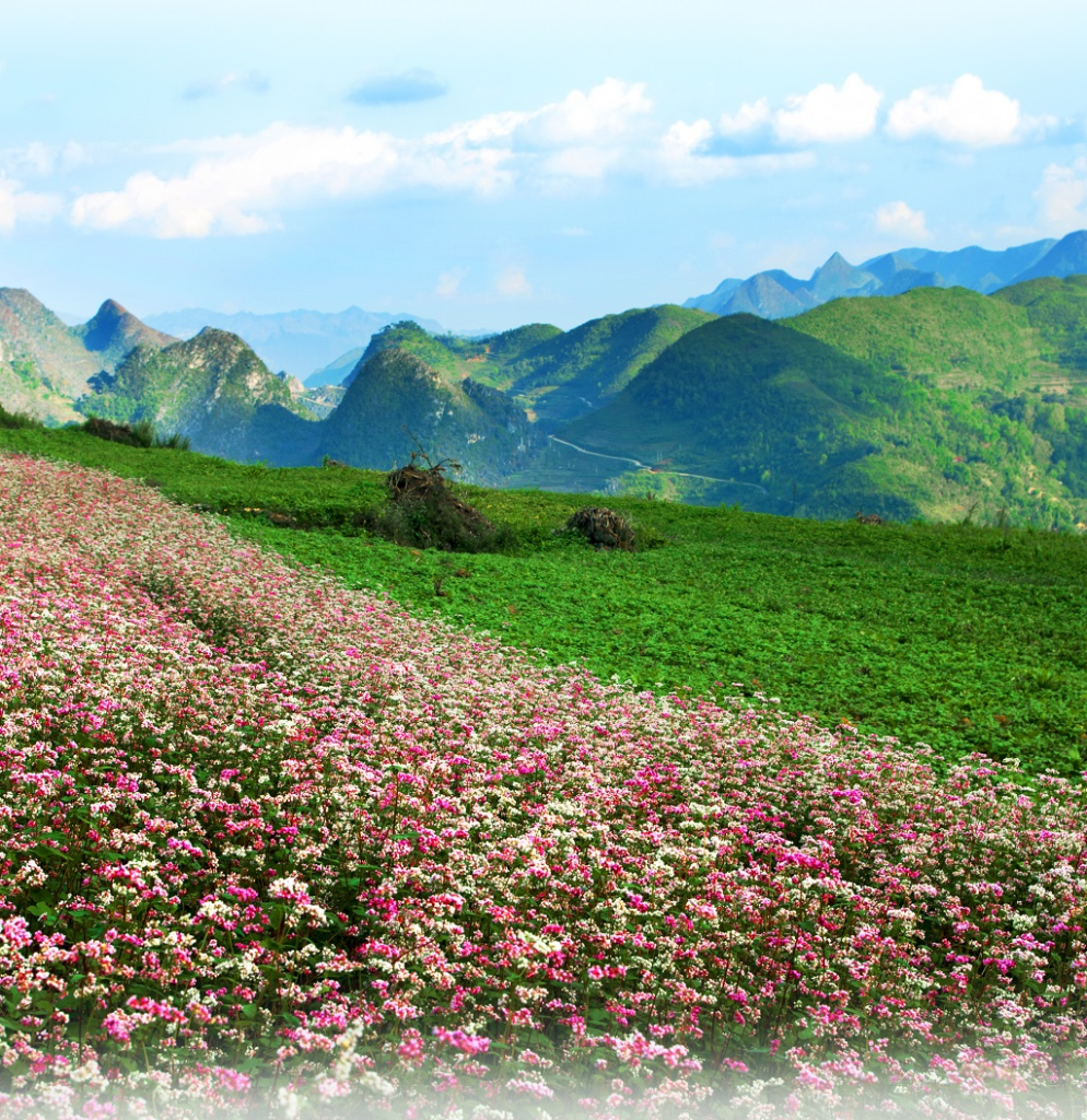
Sung La Valley offers a softer contrast to the plateau’s harsh limestone terrain. The area is known for fields, traditional houses, and seasonal flowers growing between rocky hills, making it one of the most photogenic stops in the region.
Travelers may see:
- Fields surrounded by limestone formations
- Traditional homes with stone walls
- Seasonal flowers and agricultural landscapes
- Villages located between narrow mountain slopes
- Quiet rural roads suitable for photography
The valley is especially attractive when crops or flowers are in season. However, the cultural and architectural setting remains interesting throughout the year.
Lung Cam Cultural Village
Lung Cam Cultural Village is often visited together with Sung La Valley. The village is known for traditional Hmong architecture, local homes, and cultural elements that reflect life on the rocky plateau.
Visitors can explore public paths and observe how houses, courtyards, and stone walls are adapted to the environment. Travelers should ask permission before photographing residents and avoid entering private homes unless invited.
Tham Ma Pass
Tham Ma Pass is another scenic road section within the Dong Van Karst Plateau. The road curves sharply through the mountains, creating a well-known viewpoint where visitors can see the route winding across the hillside.
This stop is popular for photography, but travelers should remain cautious near traffic and road edges. Allowing enough time to observe the pass safely creates a better experience than stopping briefly in a crowded area.
Local Markets
Local markets are among the best places to understand the cultural diversity of the plateau. These markets often bring together Hmong, Dao, Tay, Nung, and other ethnic communities from surrounding villages.
Depending on the location and market day, visitors may find:
- Fresh produce and mountain herbs
- Traditional clothing and embroidered textiles
- Farming tools and household goods
- Local snacks and regional dishes
- Livestock and agricultural products
Markets are active community spaces rather than performances for visitors. Travelers should move respectfully, avoid blocking vendors, and ask before taking close-up photographs.
Creating a Balanced Geopark Route
Travelers with limited time can focus on Dong Van Old Quarter, Ma Pi Leng Pass, the Nho Que River, and one or two cultural sites. Those with more time can add Lung Cu, Pho Bang, Sung La Valley, local markets, and smaller villages for a deeper understanding of the region.
Overall, the best places in the Dong Van Karst Plateau reveal the close relationship between geology, culture, and daily life. By combining iconic viewpoints with historical sites and local communities, travelers can experience the geopark as more than a scenic road trip.
Read for more information:
- https://abite.asia/ba-be-lake-national-park-everything-you-need-to-know-before-visiting/
- https://abite.asia/ban-gioc-waterfall-vietnams-most-spectacular-border-waterfall/
- https://abite.asia/ba-be-lake-ban-gioc-waterfall-tour-complete-2d1n-adventure/
At Abite.asia, we specialize in curated Vietnam tours for international travelers, ensuring an authentic and hassle-free experience. Let us take care of your journey so you can fully embrace the beauty of Vietnam. Contact us today at +84363770835 to start planning your adventure!

Leave a Reply